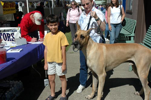
The day started out this morning with Cricket and Lucas going to a dog show here in Aurora. Adam and I were not that interested in going, so we stayed behind. They did have a lot of fun there watching them perform tricks and stuff. Cricket took a bunch of photos and I think this one was my favorite. If Lucas felt short before, now he's really feeling short!
After they returned back to the RV, we had lunch before heading out again.
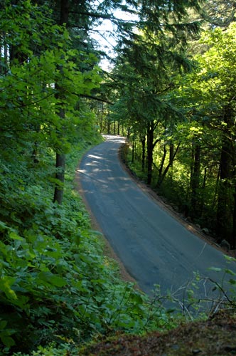
We then took a short drive up I-5 to I-205 around the east side of Portland to catch I-84. Going east a few miles was the Oregon Historic Highway 30. Along this short stretch of Hwy 30, I think about 15-17 miles long, there are 77 waterfalls. Most of them you have to hike to and are seasonal. However there are a few which can be viewed from the roadway or within a short hike.
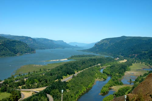
Our first stop was the Crown Point State Park which gives you a birds eye view of the Columbia River Gorge area. What a spectacular view. If only I had a very wide angle lens!
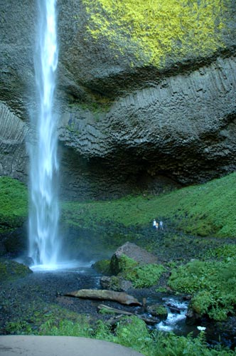
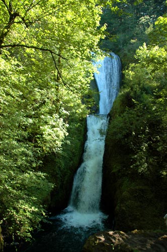
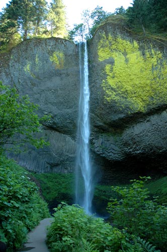
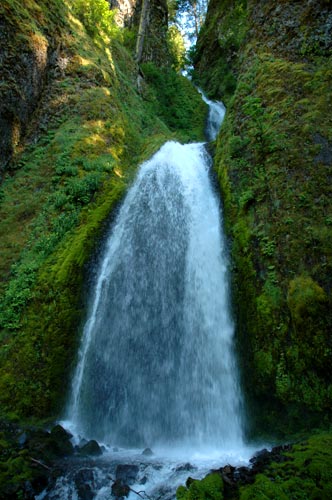
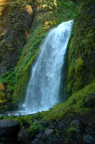
The first of the falls we saw was the Upper and Lower Latourell Falls. We went to the upper falls first. It was a 0.8 mile hike up into the woods along Latourell Creek. It has a short 25 feet first plunge followed by a 75 feet second plunge.
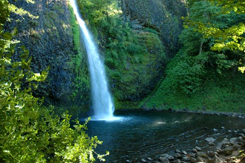
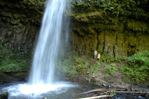
The lower falls can be scene with a short hike from the parking lot. It is a 249 foot plunge of the Latourell Creek. The boys and I tried to walk around near the back for a photo, but were getting drenched by the cold spray coming off the water.
Next was the Bridal Veil Falls. After the long hike at Latourell, Cricket and the boys were not up to this one and waited in the car. It was a short 2/3 mile hike one way to view the falls which I jogged going down. Coming back uphill as fast as I could was another story. Anyway, the Bridal Veil Falls is a tiered waterfall with the upper being about 60-100 feet and the lower about 40-60 feet. Although in the photo it looks the opposite. Must be the angle of viewing it.
Our next stop was the Wahkeena Falls, a multi-tiered waterfall. It is hard to capture it in the photo because of the different levels and the surrounding landscape. I think the total length was around 250 feet. We did hike the paved 0.2 mile steep trail to the fan part of the waterfall that was about 25 feet in height.
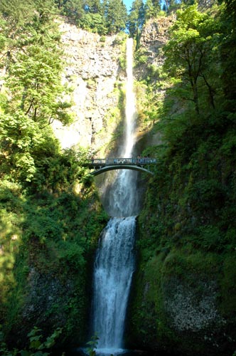
The most popular is the Multnomah Falls. Plummeting 620 feet from Larch Mountain, it is the 2nd highest year-round waterfall in the United States. Because of its size, the restaurant, the visitors center, and the fact that it was a warm Saturday afternoon, the place was VERY busy! A quick look and photo and we were off. We didn't even consider taking the hike up to the bridge because of all the people.
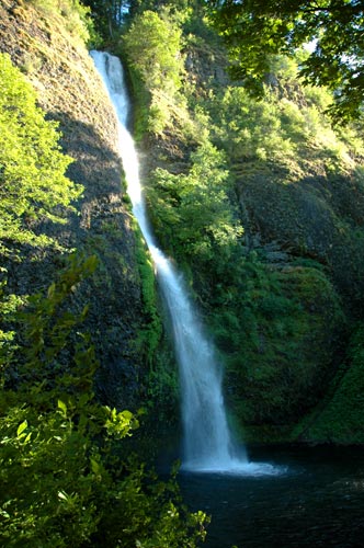
Our last stop was the Horsetail Falls. It can be viewed from the road, but I had to get out for some photos. This one plunges 176 feet into a small pool of water before flowing out under the road.
After that we merged back over to I-84 and returned to the RV. If you happen to be in the NW Oregon area, this is a must see scenic highway. However, if you're driving in a motorhome over 25 feet I would not recommend it. There are some tight curves and narrow bridges. This is a state park right there on I-84 in which you could probably park your motorhome or trailer and take the tow vehicle. Another suggestion I think would be to come in the morning hours if you want to get some good photos. Late in the afternoon while we were there it was hard to get some of the angles because the sun would be to hot on part of the falls and shadowed on the rest. Whatever you do, just don't miss this.
That's it for today. Tomorrow we're going over to Mt Hood and I'll have another update.
See you back soon,
Mark
Standing behind the upper Latourell Falls:
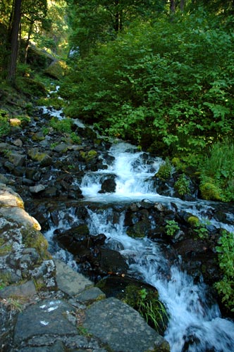
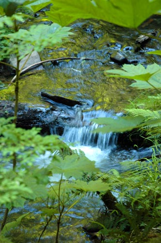
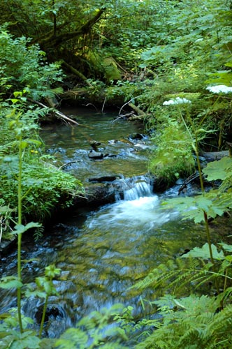
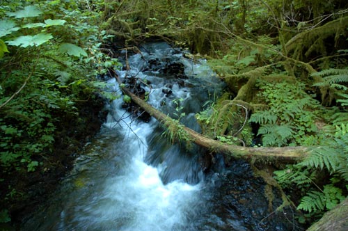
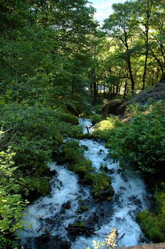
Views of Latourell Creek:
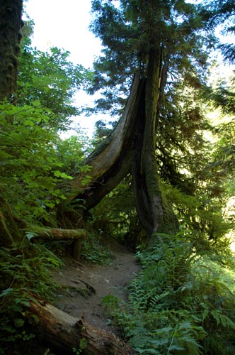
This tree looked like it had two legs:
The larger lower Latourell Falls. This is the one from above in which the boys and I were standing near the base:
This is the scenic and Historic Highway 30:
The upper fanning section of the Wahkeena Falls from the trail bridge passing in front:
Looking down from the bridge:
Another view of the Horsetail Falls: