Well hello again to all and thank you for returning to our adventures. I hope you have been enjoying our stories and photographs as we travel around the country in our motorhome. I would also like to mention that if you haven't already, please register in the message boards and post a note saying hi. We love hearing from those who are following along with us and hope to meet you one day when we visit your area. And if you have a few extra minutes, please also visit some of our advertisers to the left of this page. They help make this all possible.
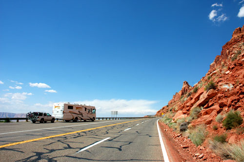
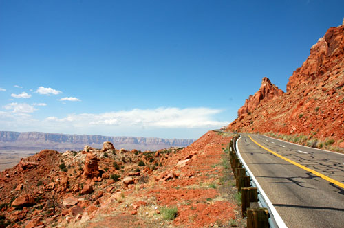
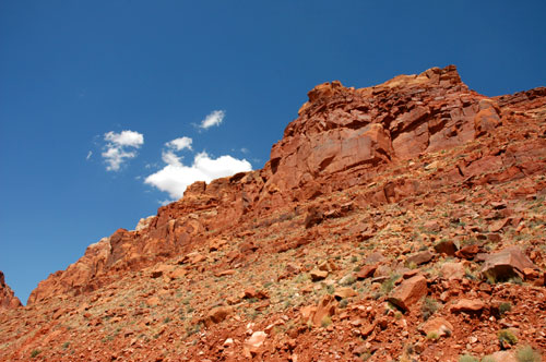
Our latest stop brings us to Page, Arizona, located to the north-east of the Grand Canyon. Leaving the south rim via Hwy 64 east, we past by Desert View to Cameron and Hwy 89 north alongside the Painted Desert and Echo Cliffs. We stopped several times along the way to admire and take pictures of the views. The closer we got to Page, the better they got.
We arrived at the Lake Powell RV Park and Campground Sunday afternoon and quickly setup camp. They didn't have any full-hookup sites available for tonight, but there are some checking out tomorrow and we'll move to another site. So for tonight, we have to settle for water and electric only. But after dry camping at the Grand Canyon for a week, even this is a luxury!
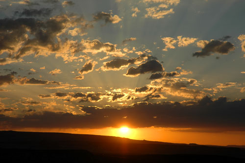
That evening we drove around a little bit to check out the area. At sunset we drove up this one hill that overlooked the marina and Lake Powell to the east and a beautiful sunset to the west.
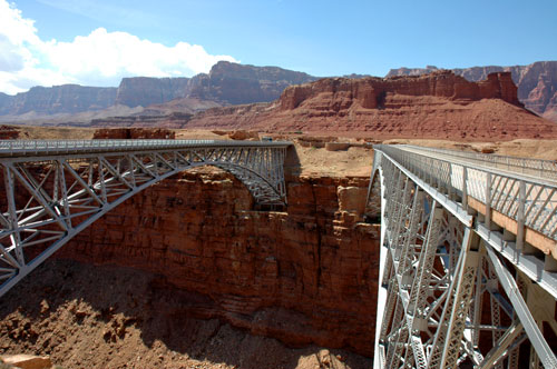
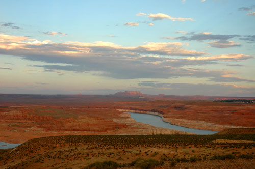
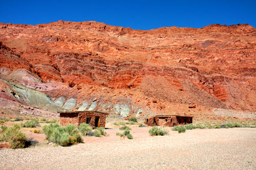
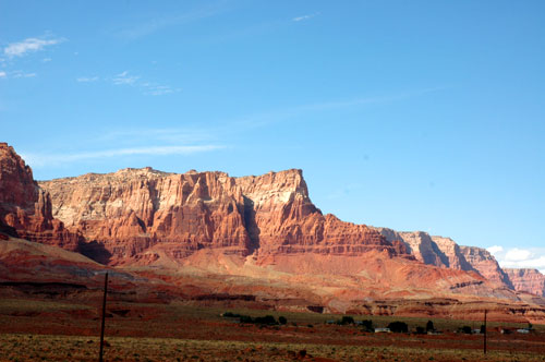
We really didn't have any plans for the few days while we were here except for Tuesday afternoon. So after the boys finished their homeschool lessons Monday morning, we drove around again and searched for some GeoCaches. This time we drove back south down Hwy 89 to Hwy 89A and turned north-west. This took us to the Navajo Bridges and the historic Lee's Ferry Crossing. Back in the 1800's and until the 1920's the Lee's Ferry was the only point at crossing the Colorado River unless you went hundreds of miles out of the way. In the 1920's, the Navajo Bridge was opened and allowed for easier traveling across the river. And as vehicles and trucks became bigger and heavier, the second bridge was completed and opened in the 1950's. The original was converted to a walk-over bridge and observation platform.
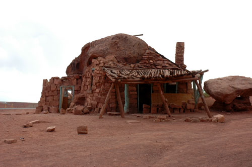
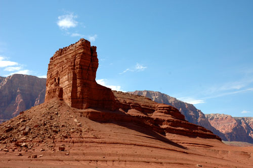
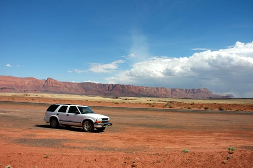
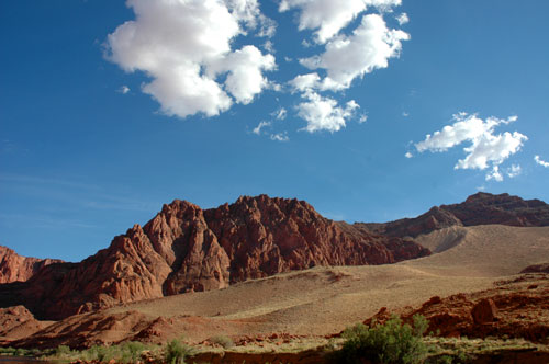
From there we continued down Hwy 89A alongside the Vermilion Cliffs to what used to be a home built among the unique rock structures. In the 1920's a woman was driving through this area when her car broke down. She fell in love with the surroundings and decided to build her house among the rock formations. Although no one lives there today, the land is still privately owned by her family and often visited by travelers passing by.
Continuing down Hwy 89A, we finally arrived in Fredonia. From there we turned north for a few miles up into Utah arriving at a town called Kanab. In Kanab we first stopped at a McDonald's drive through for some quick food before rejoining Hwy 89 east through southern Utah and eventually back down to Page. This loop took longer than I expected, but it was worth it. Some of the views along the way were spectacular.
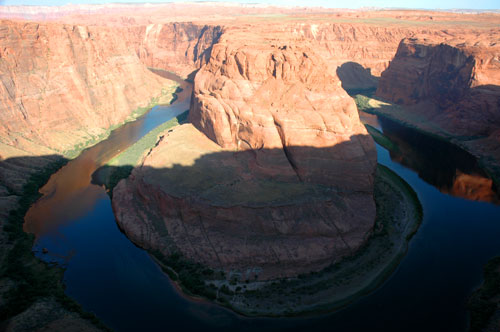
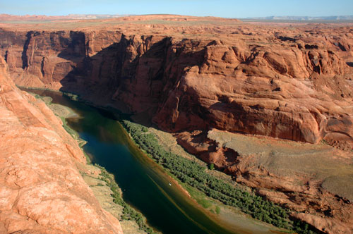
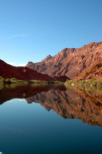
Tuesday came and since the sun is usually beaming through the windows at 5:00 a.m., I woke up and had trouble getting back to sleep. So I decided to head out early and start looking for some more GeoCaches by myself. My first stop was at the Horseshoe Overlook. This was a unique area of the Colorado River that curves around like a horseshoe. I've seen this photo used a lot in reference to the Grand Canyon, but it isn't really located at the highly visited South Rim area. It's up here in the north-east near Page. After taking some photos of the canyon and river, I searched out the GeoCache which was about a 3/4 mile hike around the rim to the south.
Then I sought after a few more caches at the Glen Canyon Dam overlook, at the AZ-UT border, and the Lake Powell Marina overlook. GeoCaching is really a lot of fun and takes you to some great spots you wouldn't normally go to visit. My last one in the area was out along some dirt roads in the desert. Because of the drought, it didn't take long before I ran into some really soft sandy areas. Even in 4x4 mode I twice thought I would get stuck. Therefore I decided it best to abandon the search and turn around.
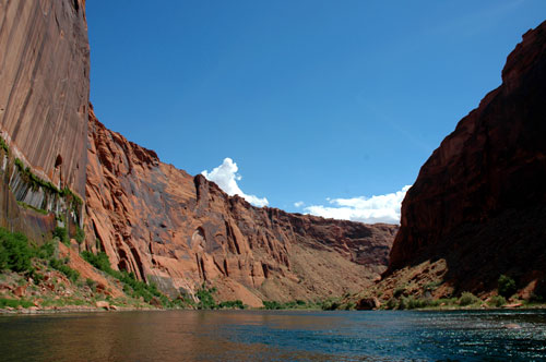
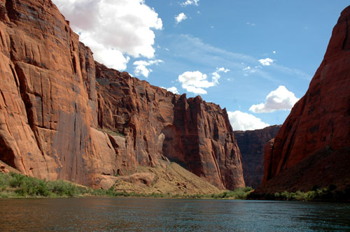
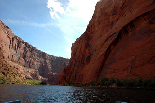
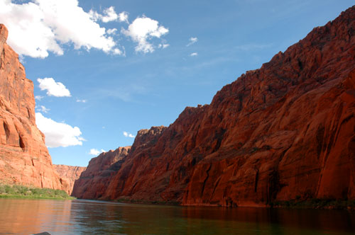
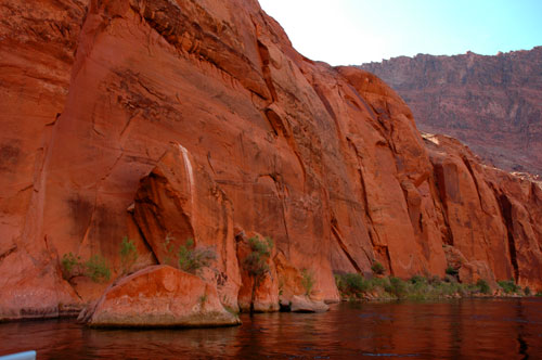
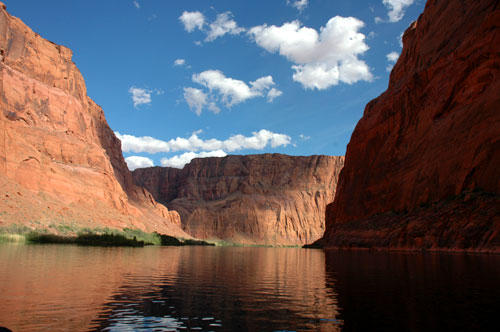
Before returning to the RV I stopped by WalMart to buy some groceries. When I returned, Cricket and the boys were enjoying the swimming pool at the campground. Soon we had lunch and got ready for our 15.5 mile float trip down the Colorado River.
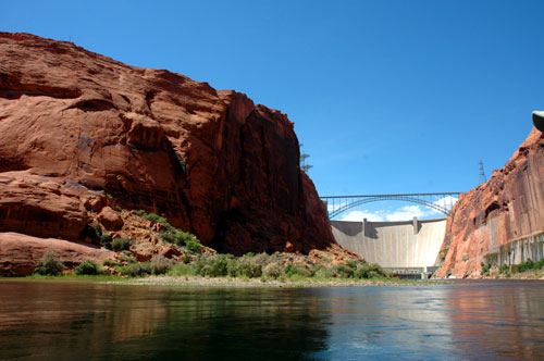
After lunch, we drove into town to the West River Adventures office. There we boarded the bus that I thought would take us near the base of the dam where they would put the rafts into the river. Instead, they actually drove us down river a ways to the entrance of a two mile long tunnel which then led to the base of the dam.
Anyway, there were enough people here that we boarded two rafts. Even though the large raft had a motor on it, the float trip still took approximately 4 hours to complete the 15.5 mile journey. There were about 20 people on our raft coming from as far as New York, Holland, and Italy. We also met a retired couple on board who was also from Central Florida!
It was a hot trip! Fortunately, they provided plenty of water, lemonade, and sodas to drink! Along the way our guide told us about the history of the dam and pointed out some interesting spots. We even stopped along the way at a beach were there were some petroglyphs carved into the canyon wall. It was a very enjoyable trip.
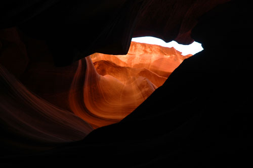
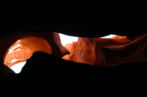
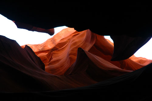
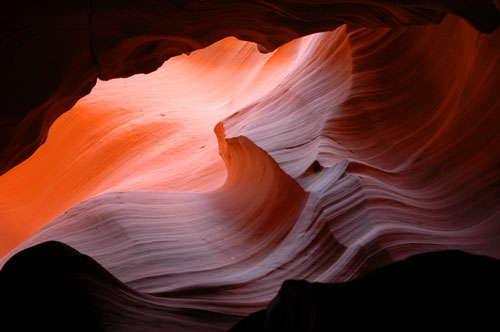
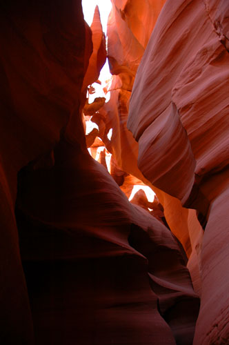
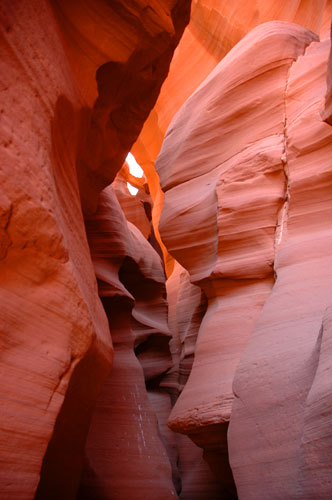
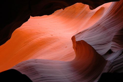
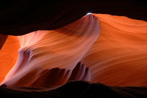
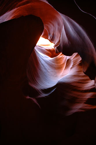
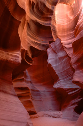
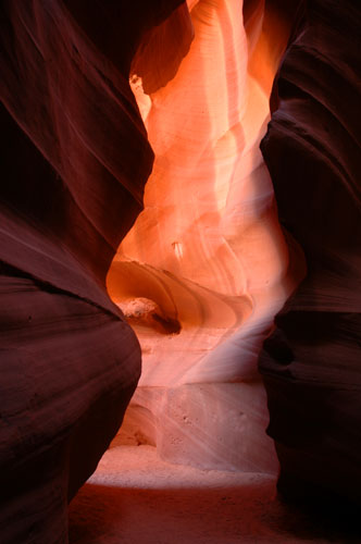
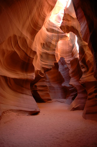
This morning before getting ready to leave we were speaking to our neighbors. Another thing we wanted to see in the area was the Antelope Canyon, but we did not know where it was exactly. Our neighbors then informed us that they had just gone yesterday and it was right around the corner! We still had enough time to visit before checking out. So we all hopped into the Blazer to go check it out. The narrow canyons were a pathway which were commonly used by antelope many years ago. However do the the diminishing vegetation, they have since disappeared also.
A short 4x4 ride later in the back of a pickup along with some others, we were given a one hour tour by a Navajo woman who grew up in the area. Antelope Canyon was sitting below a wash. Which, if you're like me and didn't know before coming to the desert, a wash is a dry creek bed or runoff for rains. Over the years, the rain water eroded the sand away and eventually cut into the sandstone. Now, this one often gets flash floods from the hills nearby. If there are rain clouds 20 miles away they close the canyon to visitors. The water passing through the canyon has created these smooth walls through the sandstone and when the sun passes overhead it creates these cool effects. The bests times to see these are in July and August between noon and 1 p.m. But we're here now and it still was nice to see.
Now we're on the road and headed to Las Vegas for a few days. We'll be taking the northern route down Hwy 89 again through Utah again. This time going all the way through Zion National Park before dropping back down briefly into Arizona and then into Nevada.
We'll see you back again soon in a few days.
Mark
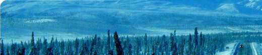
Going north on Hwy 89 on the way to Page, Arizona
Just a couple of buildings still standing from Lee's Ferry Crossing
The Colorado River at the Lee's Ferry Crossing
Driving down Hwy 89A with the Vermilion Cliffs in the background.
Some of the rock structures near the rock house in the desert.
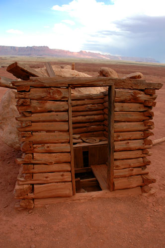
The outhouse:
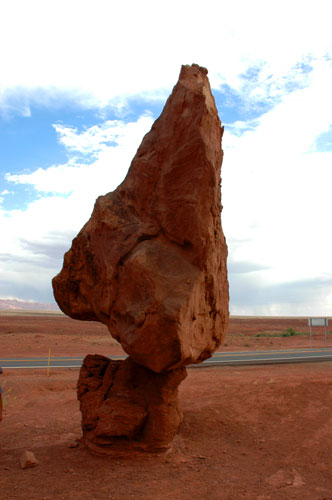
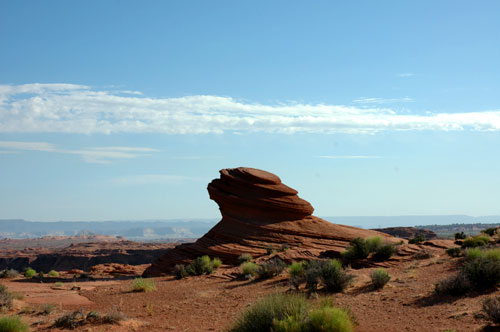
A sandstone structure above the rim near the Horseshoe Overlook:
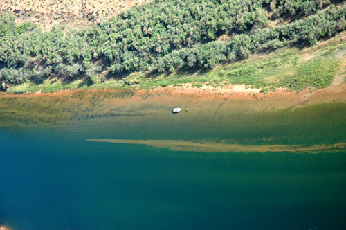
Looking down at some fishermen on the Colorado River:
From the Colorado River float trip:
Photos from Antelope Canyon: