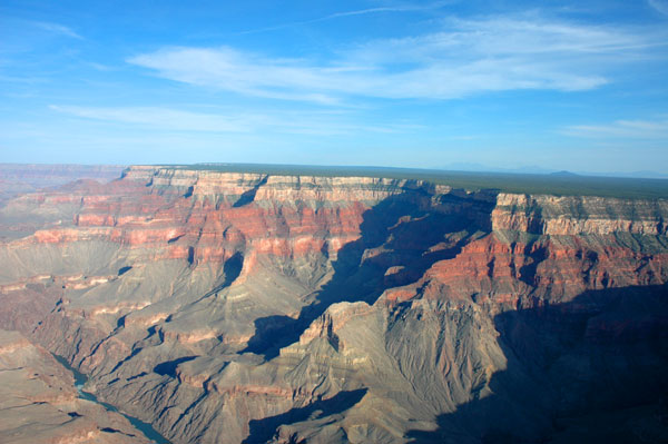
WOW! What a week it has been. We arrived at the Grand Canyon last Saturday, purchasing the National Parks Pass at the gate. Now we won't have to pay admission to anymore National Parks.
Anyway, we didn't make reservations here because we weren't sure when we would arrive. There are two campgrounds here at the Grand Canyon's South Rim. As we drove towards them, we past by the rim and got a sneak peak through the trees. Wow! We made it to the first camping area but they had a maximum RV length of 27 feet. We are 36 feet long. OK, so we drove over to the other campground but there were not any available sites. So much for that.
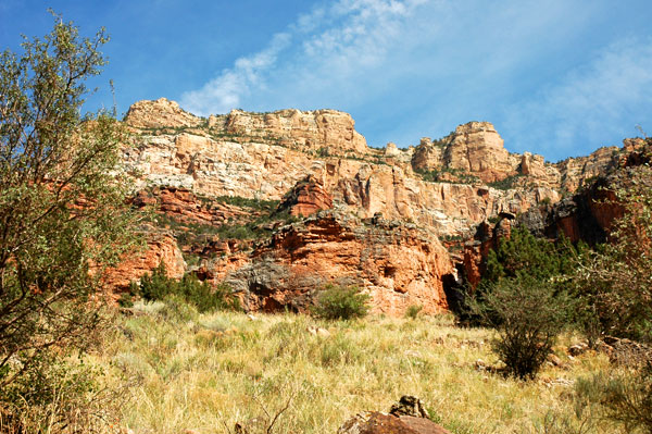
We then drove back out of the Grand Canyon National Park. About 2 miles outside the entrance is a small town called Tusayan. It's mostly just hotels, restaurants, and such for tourists. I didn't see any houses anywhere. They had one campground there but it was $49 per night and we didn't want to have to pay that much. So we continued back south on Hwy 180 just one mile and there was the Ten X National Forest Campground. They didn't have any hookups, but it was only $10 a night. SOLD! There aren't a lot of campers here, but even if there were the spaces are far apart. We had lots of room and it feels like we're in the middle of nowhere.
Well we opened up the RV slides, got the satellites pointed, and had some dinner. Since it was already late in the day, we decided to stay in for the rest of the day.
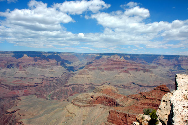
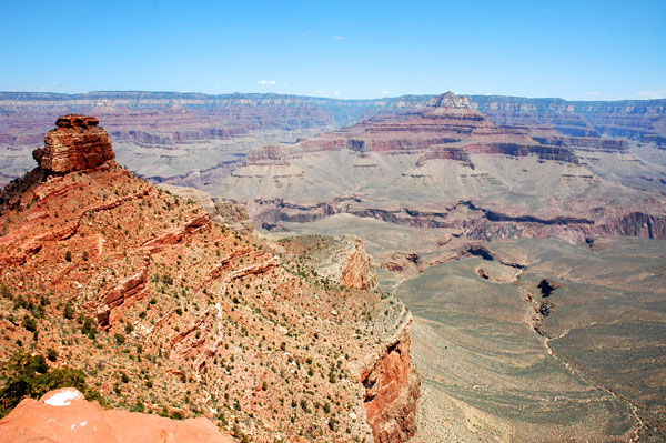
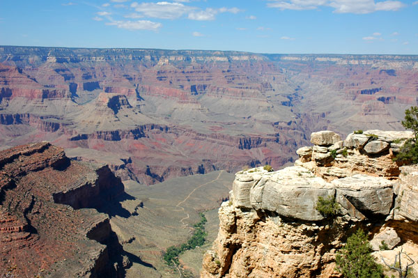
On Sunday, we drove into the Grand Canyon and parked at the South Rim. Wow again! This was a huge hole in the ground. We walked along the edge and made our way to the visitors center. They had lots of information on display there about the different hiking trails, what to prepare for when hiking, and other safety issues. I also went to the service desk to ask a few more questions and get two Junior Ranger booklets for the boys.
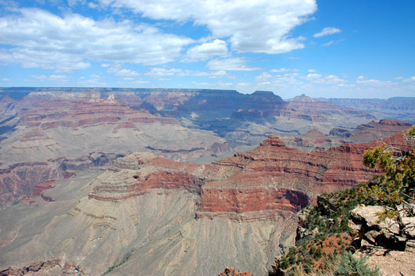
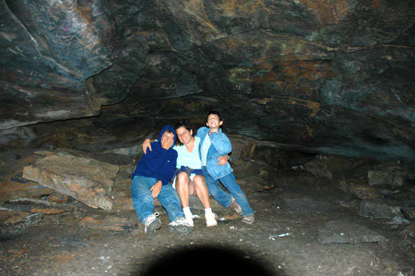
After getting all the information we needed, we walked back to the South Rim Trail and headed west. We walked about 2-3 miles I think over to the Lodge areas. When we arrived, there was a show being put on by the Hualapi Indians. We watched them for a while as they performed different traditional dances. They ranged in age from 19 down to 5 and were really good. The leader, who was probably in his 40's or 50's, played the drum and chanted the "song". When they were finished, we hopped onto the shuttle back to the visitors center to get our car.
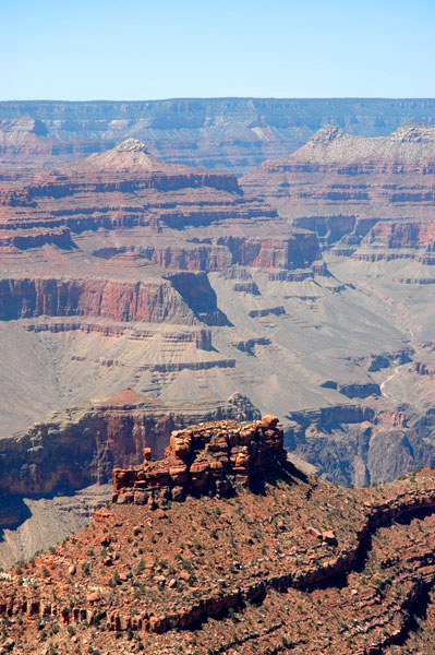
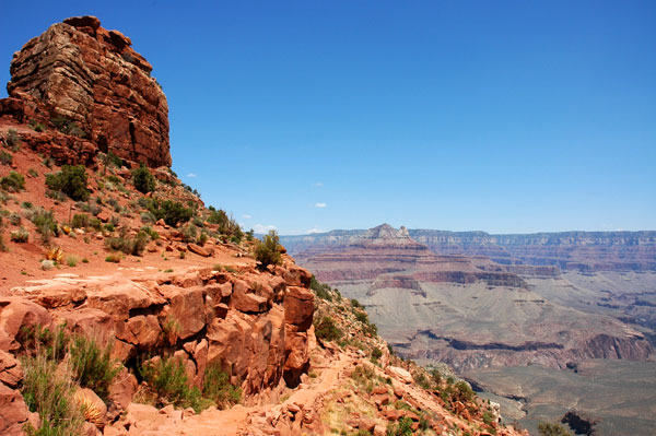
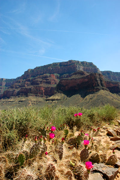
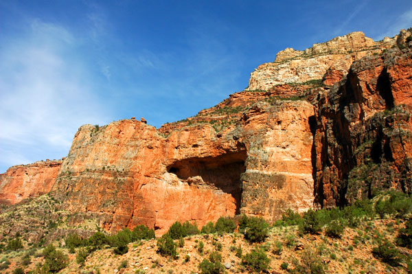
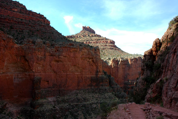
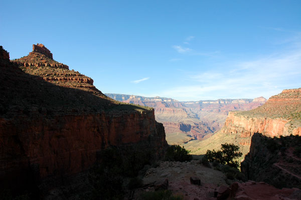
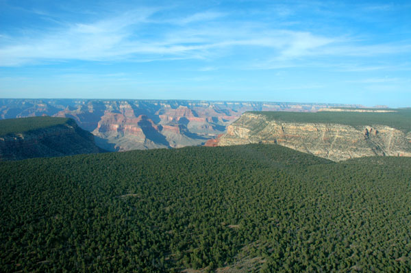
Monday began our first test of hiking below the rim. Of the more than 5 million visitors the Grand Canyon gets each year, less than 10% actually go below the rim into the canyon. We were not going to be one of the 90% who stay at the top. After the boys finished school, we packed plenty of drinks and snacks into our backpacks and headed out. Parking near the visitors center, we then took the shuttle bus over to the South Kaibab Trailhead. We were not going to do the whole trail down, but this would give us a good sample of what to expect on another trail. They say that for the amount of time you spend going down, double that amount just to go back up.
We started down the Kaibab Trail at about 12:30 p.m. and 7200 feet. The views were spectacular. Going down was easy. We arrived at the first rest stop, Ooh-Aah Point (6320 ft) and took a short break before continuing. The next stop was Cedar Ridge at 6060 feet down. Along the way we past a couple of the mule trains on their way up. The next stop was Skeleton Point at 5200 feet. Hiking down 2000 feet along a three mile trail, we decided to turn back. We were not tired yet, but knew the uphill was the most challenging. And it was. Our total hiking time was 6 hours.

The next day was recuperating day. Well not really. This time we left the Blazer at the campground and drove the RV into the Grand Canyon to empty the tanks and fill the fresh water at their campground. We then drove back south on Hwy 180 about 20 miles to a REALLY SMALL town called Valle. Verizon had cell phone service there and Cricket needed to make some business calls. I also used the laundry facilities at the Flinstones Campground there. And since they only had 2 washers and 1 drier, we spent about 3 hours there. But we were able to get a lot done. Cricket caught up with her work and I was also able to make reservations for a helicopter tour and river rafting.
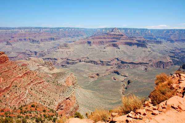
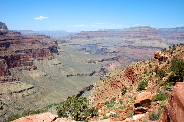
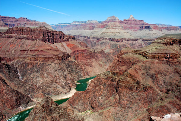
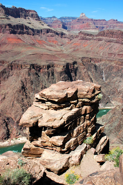
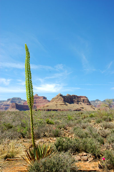
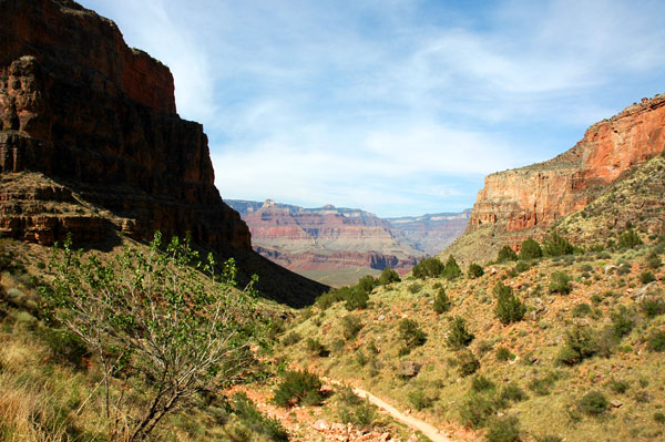
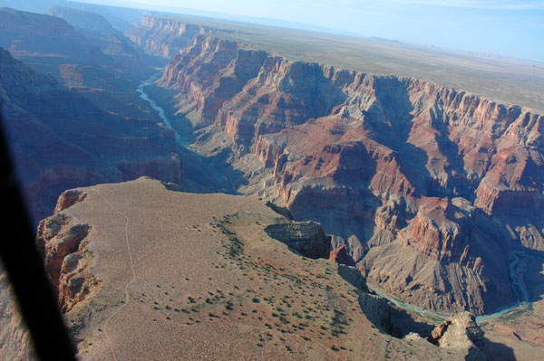
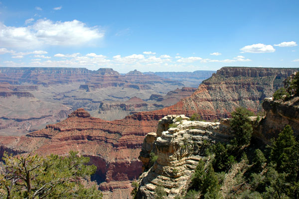
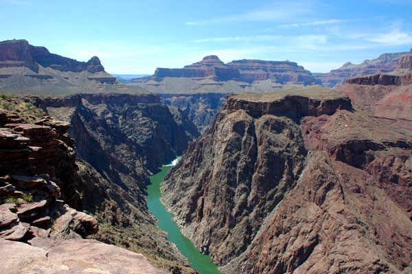
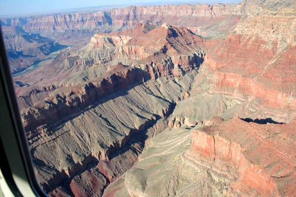
On Wednesday, we left the RV about 10:30 a.m. and made it to the Bright Angel Trailhead about 11:00 a.m. The starting elevation is 6785 feet and our goal was Plateau Point at 3770 feet, with a hike of 6.1 miles ONE WAY! From Plateau Point you can see the Colorado River another 1500 feet below it. In the photo, do you see that brown line running across that flat green area? That is Plateau Point and our goal for that day.
As before, going down was easy. We had no problems on the way there and stopped at the three rest areas along the way to stay refreshed and hydrated. That third rest area was called Indian Gardens and it was like an oasis. It had lots of trees and a cool breeze which made it almost tropical. In the same photo above you can see it there in the middle below the Plateau. We had stayed there for about 30 minutes to get a good rest because there isn't any shade at all on the Plateau and it was a three mile round trip hike. Adam and Lucas were already wanting to go back up. After chatting with some of the other hikers who had been camping there overnight in tents, we began our hike out to Plateau Point.
Once we started out onto the flat area and began to look out at the canyon walls that surround you, it was an incredible view. From the rim looking out, the ground is flat with this huge canyon "hole" so to speak. From down on the inside, they're huge mountains that shoot straight up. And with the north and south rims 10 miles apart in this section, they don't look that far away.
Anyway, as we began across the Plateau we could really feel the temperature difference. Up at the rim, it was in the low 80s. At Indian Gardens it felt like the 70's. But out on the Plateau with the sun beating down it was in the 90's. Adam and Lucas were still complaining and wanting to turn around. About halfway across, Cricket began to be torn about which way she wanted to go. She really wanted to go to the point to see the Colorado River below, but the sun was also getting to her. According to our GPS, we only had about one tenth of a mile to go but she had decided she had enough. She and the boys turned back and waited for me at Indian Gardens while I continued on. As it turned out, it was only 5 minutes later over the next little hill that I reached the point. I quickly took a bunch of photos, enjoyed the view for a few moments, and then headed back.
Because it was flat, I didn't want to waste too much time because we had a long way back up. So using my GPS I tried to keep a pace at about 3.5 mph for the 1.5 mile hike back to Indian Gardens. Once there I took a quick rest, took my boots off and washed my feet and got plenty to drink. Now that we were all rested, we grabbed our gear and headed up. At that stop and the three other rest stops going back up, I also soaked my hat in the cold water before putting it back on my head. I think that helped the most.
Going back up from Indian Gardens was a 2900 foot climb. It was tough! We stopped at what seemed like every 100 feet to take a break. We had run out of Gatorade shortly after starting back up and the water just wasn't doing anything for me. We snacked on our chips and trail mix at the rest stops even though we didn't feel like eating just to get some carbs in us. They say to eat salty foods because too much water dilutes the saline in your body and makes your muscles cramp up. The last two miles were a bear. Lucas was the only one who had any energy. Of course he hadn't been carrying a backpack either. I had been carrying all the drinks, Cricket carried the snacks, and Adam carried the trash in his backpack. The last two miles though, I had Lucas carry the few snacks we had left to give Cricket a break. They would switch back and forth each time we stopped.
As we neared the last 100 feet it began to get crowded. There were many people up on the rim as usual. Some would venture down a short way, turn around and head back up. They all still looked clean and refreshed. We on the other hand were dusty, dirty, tired, and just flat worn out!
When we did finally make it to the top, it was such a relief! We arrived back at 7:15 p.m. The elevation change was 3015 feet down, and 3015 feet back up. The total distance was 12.2 miles round trip. Then we probably had to walk another half mile to the car. Once we sat down in the car it felt good at first, but then we quickly began to feel all our aches and pains within every muscle. How good it would have been to go back to a swimming pool or Jacuzzi. Instead, after a quick drive through stop at Wendy's, we made it back to the motorhome where we had to take short showers. But I think the views at Plateau Point made it all worth while. The photos really don't capture what it was like down there.
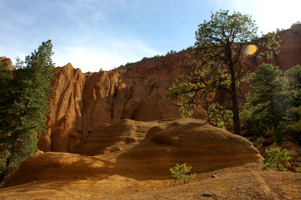
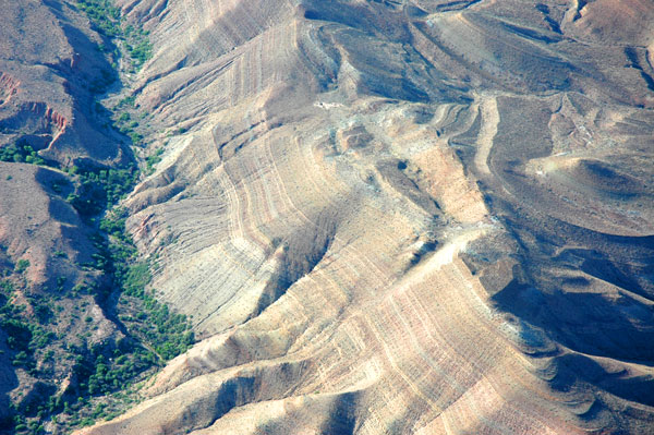
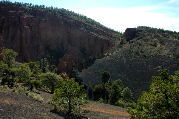
On Thursday, we took it a little easier. After the boys finished their schoolwork, we went GeoCaching. GeoCaching has taken us to some really cool places that we would never have known otherwise. The first place on today's visit was Red Mountain, south of the Grand Canyon on Hwy 180. We were not able to find the hidden cache, but the landscape here was worth the trip. Created by a volcano, these huge rock formations made for fun climbing. Lucas and I also detoured from the hiking trail following the GPS for a more direct route. This however took us gradually uphill to the top of this "volcanic slide" as I call it. It was kind of fun going down!
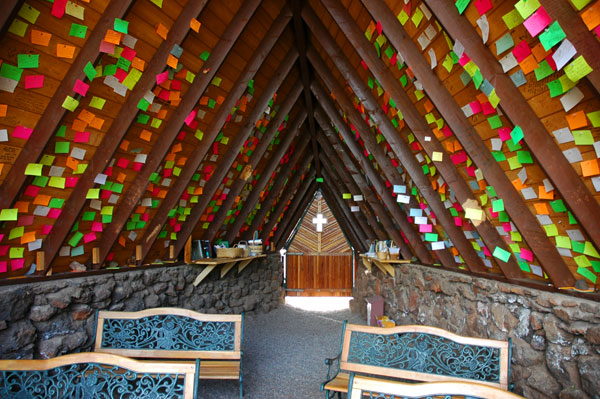
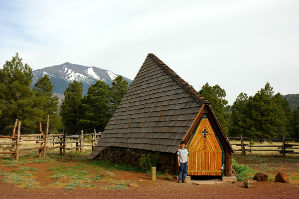
Continuing south on Hwy 180, we came across the Holy Cross Chapel. This unusually shaped chapel had a small door at the front and was unlocked for the passing visitor. The larger back end of the chapel actually had these huge windows which faced Humphreys Peak, the highest mountain in Arizona. It was a great view. Also inside the chapel stuck to the ceiling were hundreds or thousands of prayer cards left by the passing visitors. If you're ever going from Flagstaff to the Grand Canyon via Hwy 180, keep your eye out for it and stop in.
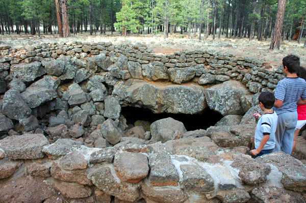
After that, we headed for our next GeoCaching search. It was called the Lava Tube and was hidden in the forest a short walk from the entrance of a lava tube. The fun part with this one was that the previous GeoCachers would found this said they left two fifty dollar bills! On the way there the conversation began about who was going to get how much money. Pretty soon it was like a scene from "It's a Mad Mad Mad World." We were all trying to determine how many shares we were getting. And the boys already had it spent before we even arrived! As it turns out the two $50 bills were actually made of rubber. I actually expected to find Monopoly money inside. Not too far off.
We were going to go down into the lave tube, but there was a group of about 50 students going in so we decided to come back on Friday. After school on Friday we headed straight for the Lava tube with our one flashlight. I would not recommend this though. You should have a backup or better yet each person have their own flashlight. I was actually using the flash sensor on the camera in short bursts most of the time.
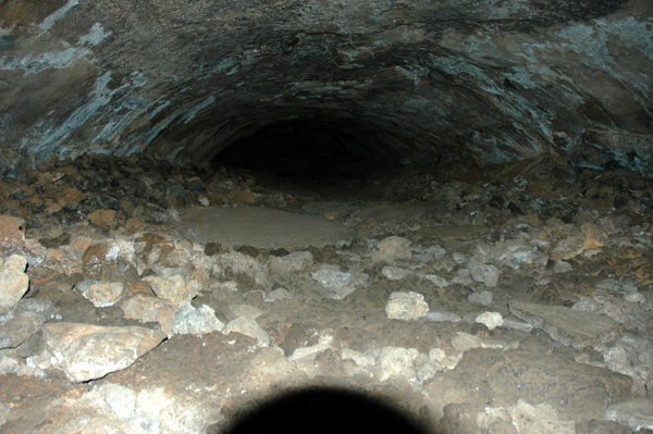
Anyway, this was one of the coolest things we've done. Literally! The temperature stays at between 32 and 40 degrees all year around. And it is FREE. Located off highway 180 and Forest Road 245, it is a short drive from the Grand Canyon. (from the South Rim directions: take Hwy 64 south, turn left on Hwy 180 to FR 245, to FR 171, to FR 171A) We tried to get Jake to go with us, but he wouldn't go down beyond the entrance. Once we disappeared into the cave, he went back to the Blazer and waited for us to return. The lava tube was 3/4 of a mile in length and we went all the way to the very end. Fortunately the flashlight batteries held up and we made it back out.
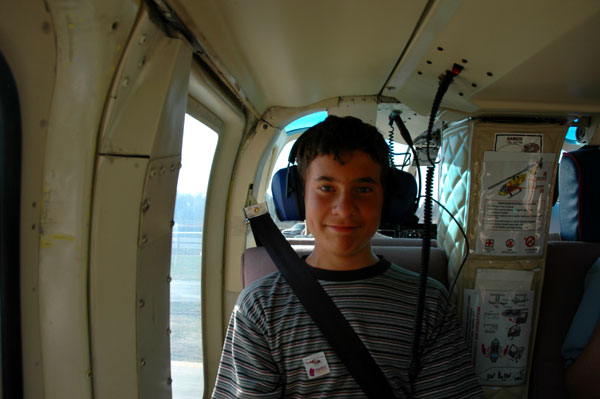
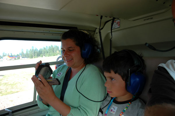
Down the road from the Lava Tube was another GeoCache site that we went to. After locating it, we went back to the RV to get a bite to eat. We had to hurry because we had to be at the Grand Canyon Airport for our helicopter tour by 4:30 p.m. That gave us just enough time to stop by the canyon post office to pick up our mail.
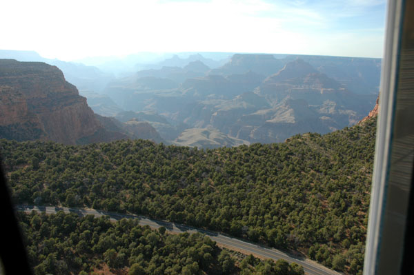
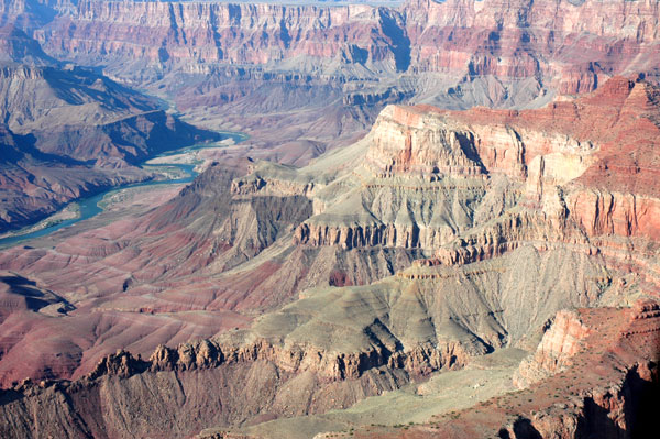
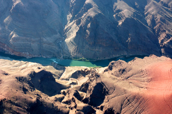
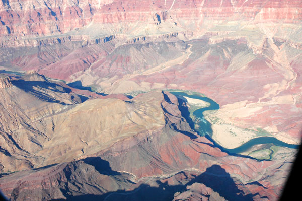
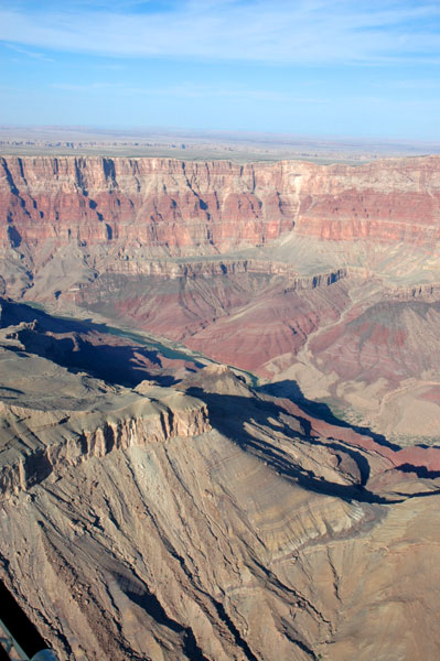
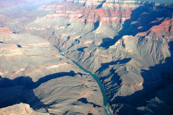
When we arrived at the airport, we checked in and then sat to watch a short safety video. Just before 5:00, the four of us boarded along with a couple visiting from New York. A few minutes later we were airborne. The helicopter headed east over the Kaibab Forest until it got near the east rim of the Grand Canyon. Then the pilot turned north. A couple of minutes later, the helicopter passed over the south rim towards the center. The sun was low to the west, the east rim on the right side of us, and a good view of the painted desert beyond it. It was a spectacular site. We had a good view of the Colorado River below us winding its way through the canyon floor. Once we reached the north rim, the pilot turned and headed west.
Because the north rim is actually taller than the south side it stays cooler. There were even patches of snow scattered all over the forest. Hopefully it will still be there next week when we drive over and camp on the north side.
As we continued flying west it seemed as though the canyon was just glowing reds and oranges as the sun reflected off its massive walls. Unfortunately the battery in my camera started to run low so I had to sparingly take pictures.
Today Cricket and the boys wanted to stay home at the RV, so I went out by myself to find some more GeoCaches. Some of the places it took me was an old stagecoach station and crater lake.
Tomorrow we leave for Page, Arizona and the north rim of the Grand Canyon. On the way there we'll be driving through the Painted Desert.
See you soon,
Mark