In the last couple of days we've changed our route twice. Upon leaving Las Vegas, we were going to head down to San Diego, California. Once we got on the road we decided to drive through Death Valley along the way because we probably were not going to be near it driving up the California coastline.
There were two options for us to take. We could take the direct route west along Hwy 160, but it was a two lane road going across the mountains. The other choice was to head south-west via I-15 into California and then take Hwy ?? north into Death Valley. This would also allow us to stop at the California welcome centers that are typically along the interstate when entering a state. We opted to take I-15 because we like stopping at the welcome centers to pick out the brochures on the things to visit within the state. However, when we got there we discovered that there wasn't a welcome center.
So we continued, finding our exit to head north towards Death Valley. It took a bit longer than we had anticipated. By mid-afternoon we were looking for an off the highway parking spot in which we could boondock in the desert. (For the non-RVers who are following our travels; boondocking is when you park on public lands usually in the middle of nowhere without any hookups.) We took off down this one road that looked like it would be a great spot. Because it was gravel, dirt and very bumpy it was slow going in the motorhome. After a couple of miles down, we discovered that it was a pay-to-use area. It would cost us $20 to park in the middle of nowhere without any hookups. No thanks! So we turned around and headed back to the highway.
Going further up the road, we encountered a roadblock. A tractor-trailer hauling cement bags had blown over on a curve. Traffic was halted in both directions when we got there as tow trucks were trying to upright it back onto its wheels. After about 45 minutes, the road was clear and we were able to pass.
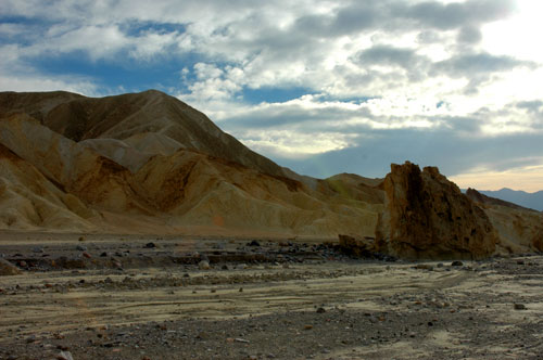
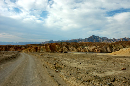
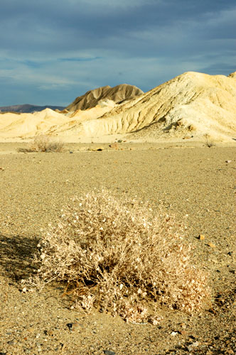
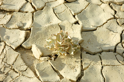
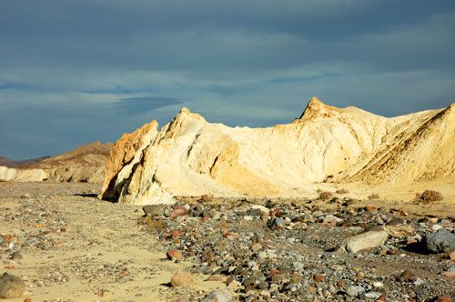
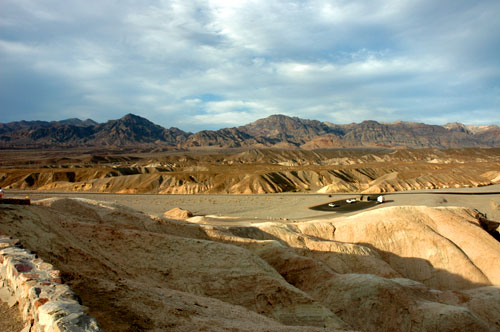
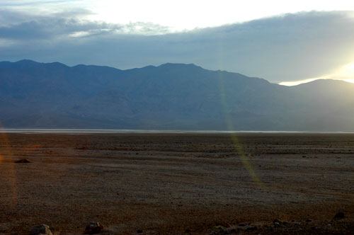
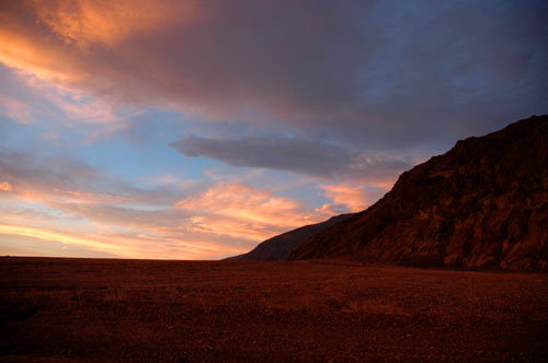
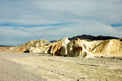
We had finally reached the Death Valley National Monument area. It was dry and hot. If it were not for the 20-30 mph winds we were getting, we probably couldn't have spent much time outside. We stopped along the road to climb some of the hills and get some photos before continuing on to the lowest part of the valley.
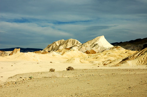
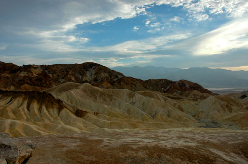
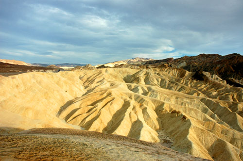
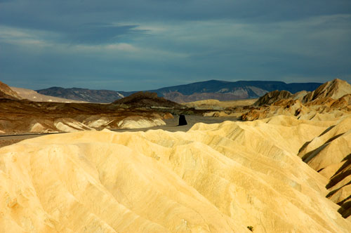
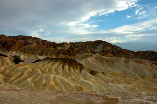
Our next stop was at Zabriskie Point. It was a high overlook and the surrounding area looked like chocolate and vanilla ice cream. The winds at the top felt like tropical storm winds back in Florida. If only we had a kite!
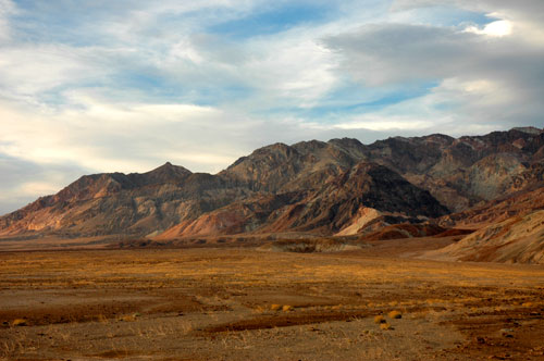
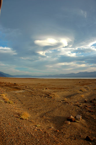
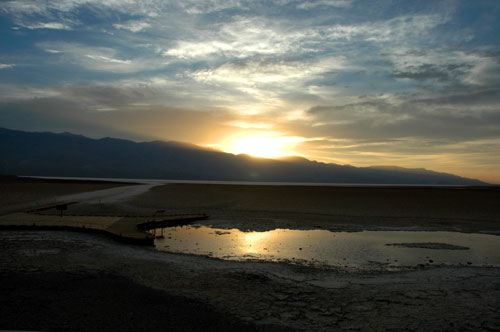
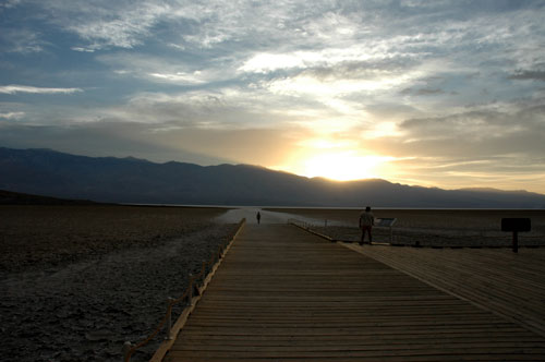
We continued around the corner to Badwater Lake. As we approached the area, it looked like a huge lake. However, as we drove closer, we realized that it was salt and not water. When we arrived at the Badwater Basin area, there was a boardwalk and sign giving the history. It was named Badwater because an early surveyor tried to get his mule to drink from the small spring. The mule refused because of the high salt content so he wrote on his map "Badwater" and the name stuck.
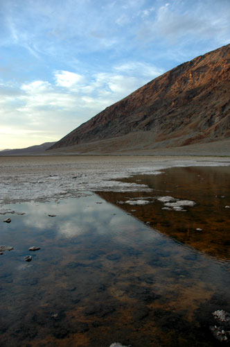
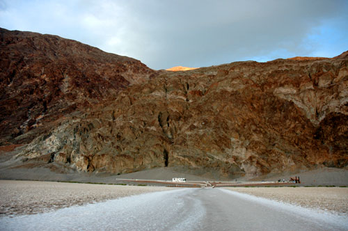
Anyway, that point is 282 feet below sea level. They have this sign up on the side of the mountain to mark the point at sea level. I parked the motorhome below it and took a photo so you could see the difference.
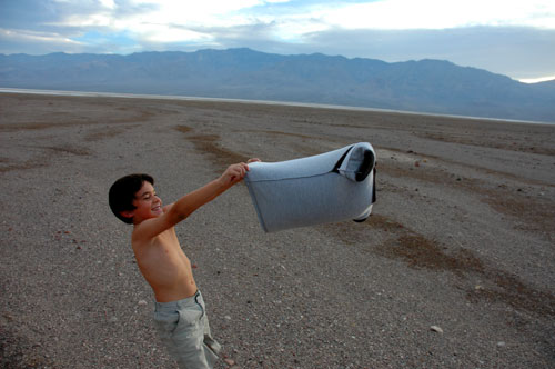
The winds were really strong there too and Lucas decided to remove his shirt and use it like a parachute to see if he could fly. I think if a only had a bigger shirt he could've made lift-off!
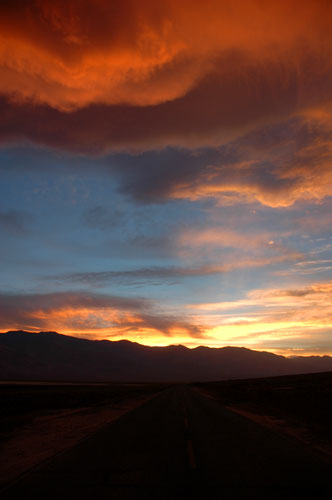
We continued down Hwy 78 for a few miles longer. Hwy 78 does continue south and then back east towards Hwy 190 at the southern end. Then we could back track towards I-15. However, looking again at the map, it appeared on the map that if we make a u-turn and went back to Hwy 190 and continued where we left off that it would be a quicker route to US 395 south.
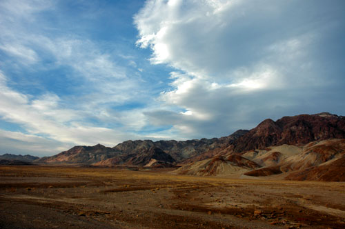
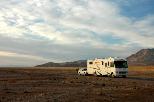
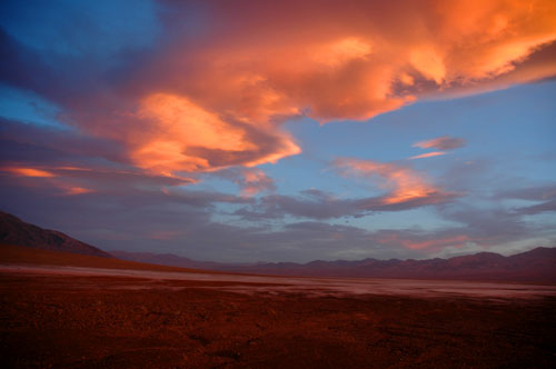
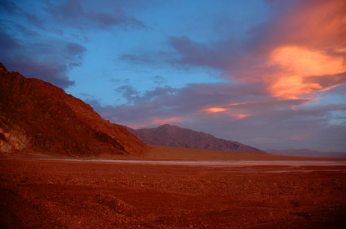
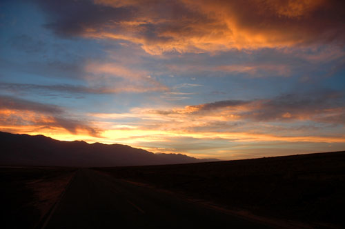
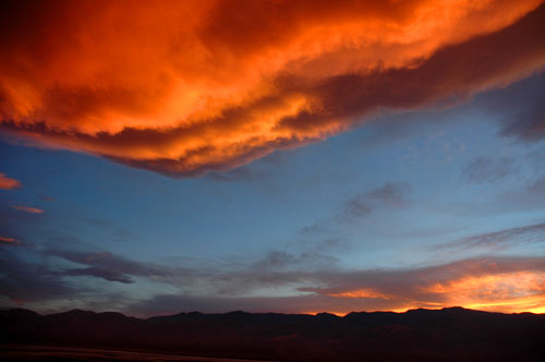
So I pulled over, unhooked the Blazer, made a u-turn in the RV, re-hooked up the Blazer and prepared to continue. At that time the sun was now setting behind the mountains across Death Valley and made for some spectacular skies. I went in and grabbed the camera before taking off. The wind was still blowing hard so that made it difficult to keep still and not to blur the photo.
Darkness had now found it way in the valley. We made it back to Hwy 190 and continued west. We finally reached the mountains and had to cross them. It was a 9% uphill grade for about 10 miles climbing from sea level to over 4000 feet! I could only go about 15 miles an hour and using up fuel fast. At 3000 feet the transmission temp warning came on. I pulled over at the next opportunity and unhooked the Blazer. It was a dark as could be. If I turned off the flashlight, I couldn't see my hand in front of my face. And I didn't want to leave the RV running and burning up gas. So a flashlight it was.
Now Cricket had to follow behind me in the Blazer along these winding roads. We turned on the walkie talkies so we could talk to each other when we needed to. And to help keep us awake. It was about 11:00 p.m. by this point. We could not see, but I'm sure the drop offs along the edge were steep. I guess it was probably a GOOD thing that I could not see them!
After cresting the top, it was now downhill for miles. I put the grade brake on and used the regular brakes hard off and on to keep it going slow. The bad thing now was that my fuel gauge now was on empty. I don't know if it was because of the angle or what, but it dropped quick.
We reached the bottom of the mountain and I saw a gas station up ahead. They were closed. We continued back up the next mountain which wasn't as bad as the first, unless it was just because I wasn't pulling the Blazer this time. After crossing over the top, I could see the lights from US 395 way in the distance. I kept praying that I wasn't going to run out of gas before I get there!
Going downhill on this side the road was almost straight so I just let the RV roll on up to about 60 mph. As long as I didn't have to touch the gas pedal, I was feeling better.
We made it to the gas station. It had a limit to the credit card purchase of $100 at $3.49 a gallon. I cycled through it twice and didn't fill up the tank so I'll never know how low on fuel I actually was.
A few miles later on US 395 and after midnight, we found a rest stop and pulled over for some much needed sleep. What a night.
The next day we continued south on Hwy 395 and re-entered I-15 just past I-10 south of Los Angeles. When I stopped at a WalMart for lunch Cricket decided to start calling ahead to some campgrounds around San Diego to see what was available. We quickly discovered that it was a holiday weekend and everything was booked. The only spot we could find was at a high end park at $65 per night. No thanks.
We continued called widening our area until we found an RV park in Cathedral City that had some sites available. Cathedral City is located about 100 miles east of Los Angeles on the other side of Palm Springs. We drove back up to I-10 and headed east. We arrived at the campground around lunch time and could finally relax!
There wasn't a whole lot to do around here. On Sunday we drove out in the Blazer 100 miles east on I-10 to Arizona. Once there we filled up on gas at only $2.89 a gallon before crossing back into California. I know what you're thinking and no we didn't drive all that way for cheap gas. Our destination was just on the California side of the border. There was this desert there that had some volcanic activity long ago. And if you dug into the ash, you could find some geodes. A geode is a sphere shaped rock which contains a hollow cavity lined with crystals.
So there we were about 15 miles off the interstate, out in the middle of the desert, digging holes in the ground looking for rocks. Not what I called fun, but Cricket and Lucas wanted to and were sure they were going to find huge geodes. I just enjoyed the offroad driving.
Needless to say we didn't find anything other than rocks and dirt. After a while we were just about to give up when we happened across another couple in a truck digging as well. We stopped and asked if they were searching for geodes and they said yes. They had showed us some of the ones they had found and a good place to look. Well we learned that we had been looking in the wrong place the whole time. We were digging in the ground when we should have been looking in the hills. The geodes are buried in the ash, not dirt.
Well we found a few small ones, but nothing spectacular. Then while climbing on the rocks, Cricket tripped and cut her finger. After she patched it up with a band-aid, she came back out to help. It wasn't too much longer after that, when she was stung by a bee. Ok, now I think its time to call it a day and head home. We told our new friends good-bye and tried to find our way back to the highway.
Along the way home we stopped and found a few geocaches. One was really interesting in that it was at a rest stop near a Gen Patton memorial and museum. Unfortunately it was closed so we could not go inside. I did get to check out some of the tanks outside behind the fence.
On Monday we just stayed at home. Well after watching a race on TV, I drove around town searching for some urban geocaches.
Today we left Cathedral City and headed down the road to Perris, CA where our motorhome was born. Perris is the home of National RV. We wanted to go through the factory tour to see how they are assembled, but by the time we finished with service and parts the tour had passed. But we did get new seat cushions ordered under warranty.
Tonight we setup camp here in Riverside, California. That's it for now. We'll see you back in a few days with some more of our adventures.
Mark